
A continuous record along the road
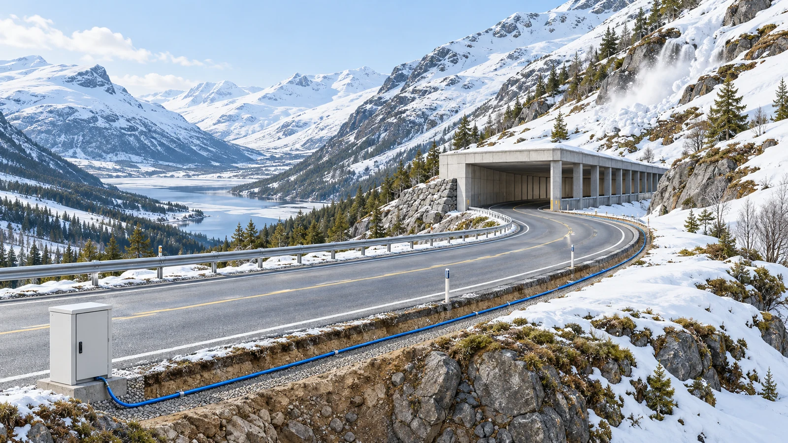
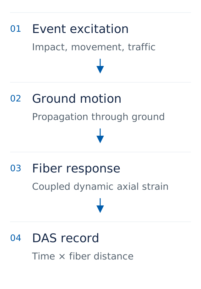
Mountain roads connect slopes, bridges and protective galleries. Impacts and vehicle movement generate vibrations that travel through the ground, roadbed and cable. Distributed acoustic sensing (DAS) records the resulting dynamic axial strain response along the fiber, retaining both time and fiber distance for event review.
A deployment survey should establish the cable route, splices, spare loops and ground coupling. Calibrated fiber distance can then be associated with road chainage. Channel spacing, the instrument's spatial response length and field event-location error require separate reporting.
Published field observations
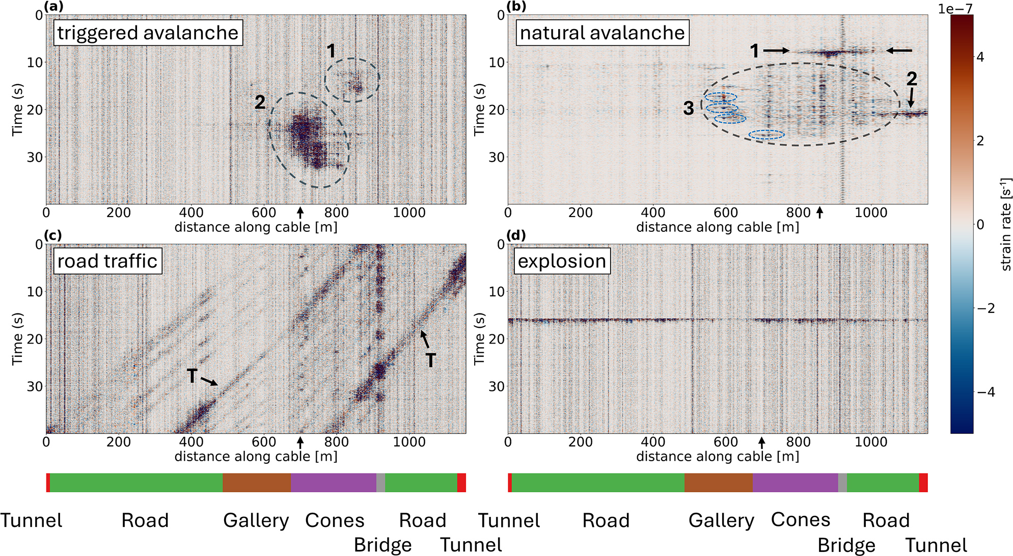
Kleine and colleagues observed approximately 2 km of roadside telecommunications fiber in Grasdalen, Norway, over three winters. DAS recorded avalanche and road-traffic signals. The study also identifies traffic interference as a difficulty for simple threshold detection. [1]
A validation plan for research and integration
The following tasks are engineering recommendations. Begin with a section where independent event records are available. Retain continuous raw data and acquisition settings so that each detection can be traced back to its evidence.
| Validation task | Records and deliverables |
|---|---|
| Route and coupling | Map fiber distance to road chainage; identify bridges, galleries, spare loops and weakly coupled sections. |
| Event reference | Align video, inspection or independent-sensor records to a common clock; retain event intervals and uncertain samples. |
| Traffic background | Cover vehicle types, traffic levels and weather; report false alarms per observation time and review missed events. |
| Model evaluation | Split training and testing by independent event, date or road section to avoid leakage between adjacent event windows. |
| System interface | Define timestamps, associated road section, confidence, evidence clips and review status; validate latency and the review workflow. |
From observations to an evidence-based workflow
Research teams can investigate cable coupling, event representation and generalization across observation periods. System integrators need to connect detection with evidence replay, communication status and operational handling. Safety-related action thresholds and permissions require their own scenario validation.
OriginSense supplies distributed fiber-optic sensing equipment, algorithms, software platforms and API customization services. A technical discussion can start with four inputs: available fiber, the trial task, required data interfaces and acceptance criteria.
Reference
[1] Kleine, F., Bruland, C., Wuestefeld, A., Oye, V., and Landrø, M. Seismic signal characterization of snow avalanches using distributed acoustic sensing in Grasdalen, western Norway. Natural Hazards and Earth System Sciences, 25, 2771–2782 (2025). DOI: 10.5194/nhess-25-2771-2025.